
LUBBOCK - 18 HOLES - FREE

LUBBOCK
CITY MAP MINIGOLF

Lubbock - 18 stops - par 58

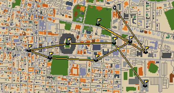
Lubbock is the setting for this round, where the map is the actual city and the ball rolls across its real streets. The holes are built from local attractions, ending at landmarks like the Buddy Holly Center. Skip knows these roads well, even the ones where the wind tries to steal a feather. This full round of 18 holes covers a walk of 8 mi with a par of 58.

Trouble loading? Open the game in its own tab.

HOW IT WORKS

01

Pick a city

The course is drawn on the real street grid, so the map you play is the map you walk.

02

Putt to the pin

Drag to aim, release to swing. Buildings bounce and water costs you a stroke.

03

Sightsee between strokes

Every hole ends at an attraction. Sink the putt, read the story, walk to the next tee.

THE LUBBOCK ROUND - STOP BY STOP

HOLE 1 - PAR 3

Joyland Amusement Park

You can find the site of Joyland Amusement Park within Mackenzie Park. It was a family-owned traditional amusement park that followed a very specific seasonal schedule. If you visited during its active months, you would find it open six days a week. On weeknights, the park opened only during the evening hours. I've noticed that the memories of these evening lights and the sounds of the crowds still linger in the neighborhood. It is a spot where local families spent their summers for a long time.


Wikidata · Wikipedia

HOLE 2 - PAR 3

Santa Land

HOLE 3 - PAR 3

Bayer Museum of Agriculture

HOLE 4 - PAR 3

American Wind Power Center

The American Windmill Museum, formerly known as the American Wind Power Center, is a museum of wind power located in Lubbock, Texas. It is situated east of downtown Lubbock on 28 acres of city park land. I always find it impressive how the exhibits are spread out; you can pick out more than 160 American style windmills on exhibition here. It is a great spot to see how these machines shaped the region, and the wide open park setting makes the experience feel authentic to the Texas landscape.

Wikidata · Wikipedia

HOLE 5 - PAR 4

Lonestar Amphitheater

HOLE 6 - PAR 3

Caviel Museum of African American History

HOLE 7 - PAR 3

Buddy Holly Center

HOLE 8 - PAR 3

United Methodist Church, Northwest Texas Conference

HOLE 9 - PAR 3

Lubbock Tornado Memorial

HOLE 10 - PAR 3

Primera Iglesia Apostolica

HOLE 11 - PAR 4

Mount Calvary Baptist Church

HOLE 12 - PAR 3

Cactus Theater

The Cactus Theater is a theatre building and movie theater located in Lubbock, Texas. You can pick out the Art Deco architecture style that defines the building's look. It is a National Register of Historic Places listed place that remains a hub for the arts. I'll let you in on a secret: the variety of shows is great, as the venue hosts live music productions, musicals, and theatrical plays. It is a great spot to see how the city blends its history with active entertainment.

Wikidata · Wikipedia

HOLE 13 - PAR 3

Burns Park

Let me show you Burns Park. This area is a park, providing a place for people to spend time outdoors in the city. You can find open spaces here to relax or walk around. I've always found the greenery a nice break from the pavement.

Wikidata

HOLE 14 - PAR 4

Mose Hood Park

Green grass and open space define the layout of Mose Hood Park. It is a park located within the city, providing a spot for visitors to relax. I find it is a good place to stretch your legs before moving on to the next landmark.

Wikidata

HOLE 15 - PAR 4

Full Gospel

HOLE 16 - PAR 4

Berry Park

Let me show you Berry Park. This location is a park where you can step away from the pavement and enjoy some open space. It is a simple, welcoming spot for anyone visiting the area to stop and stretch their legs.

Wikidata

HOLE 17 - PAR 2

Mount Gilead Baptist Church

HOLE 18 - PAR 3

Bethel African Methodist Episcopal Church

STOP 19

Mae Simmons Park

Let me show you Mae Simmons Park. This place is a park, providing a spot for visitors to stop and relax. I've found it's a nice place to stretch your legs.

Wikidata

OTHER COURSES

9 HOLES - PAR 26

Tuscaloosa

9 stops

Tuscaloosa is the setting for this round, played on the actual city streets. The map uses real attractions like Bryant-Denny Stadium to build the holes, turning the town into a course. Skip knows these sidewalks well, having spent plenty of time dodging crumbs on the way to the cup. This quick 9-hole round covers 3.2 mi with a total par of 26.

9 HOLES - PAR 28

Oceanside

9 stops

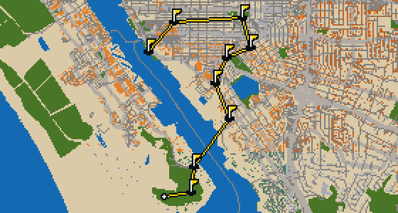
Oceanside is the setting for this round, with the ball rolling across the real streets of the city. The holes are built from actual attractions, like the Oceanside Museum of Art. Skip is a local guide who knows every curb and crumb. This quick 9-hole round covers 3.6 mi on foot with a par of 28.

9 HOLES - PAR 29

Vallejo

9 stops

The Vallejo Naval and Historical Museum is the end of this quick nine-hole round. The map is the real city and the ball rolls across its actual streets, banking off building facades. Local attractions provide the structure for each hole. Skip knows these sidewalks well, including the 3.7 mi walk and the two portals used to bridge the gaps.

9 HOLES - PAR 28

Salinas

9 stops

Salinas is the setting for this round, with the ball rolling across the actual city streets. The holes are built from real attractions, including the National Steinbeck Center. Skip knows these sidewalks well and has a few feathers in the wind. This quick round of 9 holes has a par of 28 and covers a total walk of 3.7 mi.

9 HOLES - PAR 27

Danbury

9 stops

Danbury is the setting for this round, where the map is the real city and the ball rolls along its actual streets. The holes are built from real attractions, ending at Wooster Square. Skip is a local guide who knows the pavement well. A quick 9-hole round covers 3.4 mi with a total par of 27.

FAQ

Is it free to play?

Yes. Every course runs in the browser with no account and no install.

Do I need to be in the city?

No. The full round plays from anywhere. Walking the real route is a nice way to see the city, but it is not required.

Are the maps real?

Yes. The geometry comes from OpenStreetMap data, rendered chunky on purpose. Streets, water and parks sit where they really are.