
DANBURY - 9 HOLES - FREE

DANBURY
CITY MAP MINIGOLF

Danbury - 9 stops - par 27

Danbury is the setting for this round, where the map is the real city and the ball rolls along its actual streets. The holes are built from real attractions, ending at Wooster Square. Skip is a local guide who knows the pavement well. A quick 9-hole round covers 3.4 mi with a total par of 27.

Trouble loading? Open the game in its own tab.

HOW IT WORKS

01

Pick a city

The course is drawn on the real street grid, so the map you play is the map you walk.

02

Putt to the pin

Drag to aim, release to swing. Buildings bounce and water costs you a stroke.

03

Sightsee between strokes

Every hole ends at an attraction. Sink the putt, read the story, walk to the next tee.

THE DANBURY ROUND - STOP BY STOP

HOLE 1 - PAR 3

Hearthstone Castle

Hearthstone Castle is a house located in Tarrywile Park in Danbury. Built between 1895 and 1899, the building is designed in the Shingle style architecture. You can pick out the specific aesthetic of the era, though the site has also been known as The Castle or Parks' Castle over the years. The property is owned by the City of Danbury and includes four contributing buildings along with three other contributing structures. Because of its historical value, it was listed on the National Register of Historic Places in 1987. I have spent a lot of time watching the city from above, and this spot is one of the most interesting landmarks in the park. It is a great place to pause and look at the details of the construction before you move on to your next hole.


Wikidata · Wikipedia

HOLE 2 - PAR 3

Scott Fanton Museum

HOLE 3 - PAR 2

The Vietnam War Monument

HOLE 4 - PAR 3

Lions Club

HOLE 5 - PAR 3

Danbury Museum and Historical Society

The Danbury Museum and Historical Society is a museum in Danbury, Connecticut, consisting of several distinct sites. Its main campus on 43 Main Street is home to the 1785 Rider House, the 1790 John Dodd Hat Shop, Huntington Hall, the Little Red Schoolhouse, and the Marian Anderson Studio. Beyond the main campus, the museum operates the Charles Ives Birthplace on Mountainville Avenue. Founded in 1947, the society preserves these varied structures to keep the local history accessible to everyone who visits. I've noticed the campus feels like a small village tucked away from the modern traffic, making it a nice spot for a stroll. You can pick out the different architectural styles of the various buildings as you walk through the grounds, providing a glimpse into the different eras of the town.

Wikidata · Wikipedia

HOLE 6 - PAR 4

Sacred Heart Church

HOLE 7 - PAR 3

Danbury Railroad Museum

Look closely at the Romanesque Revival architecture of this building before taking in the whole site. I can show you the Danbury Railroad Museum, a railway station established in 1994. It is housed in the former Union Station on the east end of downtown Danbury, Connecticut, and is a National Register of Historic Places listed place. The museum focuses on the history of railroading in southern New England and neighboring New York. If you wander toward the tracks, you can find a collection of heritage railcars in a rail yard it shares with Metro-North. It is a great spot to see how the region moved before the era of the highway.

Wikidata · Wikipedia

HOLE 8 - PAR 3

Saint Peter Church

Saint Peter Church is a Roman Catholic church building located in Danbury, Connecticut. This site is part of the Diocese of Bridgeport and was designed by the architect Patrick Charles Keely. It holds a specific place in regional history as the first Catholic church built in northern Fairfield County. Within the Diocese of Bridgeport, the church is the fifth oldest Roman Catholic Church and the third oldest parish. When the congregation was first established, it was predominantly Irish. Visitors can see the influence of its early community and its standing as one of the oldest religious institutions in the area.

Wikidata · Wikipedia

HOLE 9 - PAR 3

Wooster Square

STOP 10

Pentecostals Of Dnabury

OTHER COURSES

9 HOLES - PAR 26

Tuscaloosa

9 stops

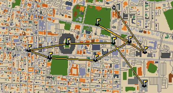
Tuscaloosa is the setting for this round, played on the actual city streets. The map uses real attractions like Bryant-Denny Stadium to build the holes, turning the town into a course. Skip knows these sidewalks well, having spent plenty of time dodging crumbs on the way to the cup. This quick 9-hole round covers 3.2 mi with a total par of 26.

9 HOLES - PAR 28

Oceanside

9 stops

Oceanside is the setting for this round, with the ball rolling across the real streets of the city. The holes are built from actual attractions, like the Oceanside Museum of Art. Skip is a local guide who knows every curb and crumb. This quick 9-hole round covers 3.6 mi on foot with a par of 28.

9 HOLES - PAR 29

Vallejo

9 stops

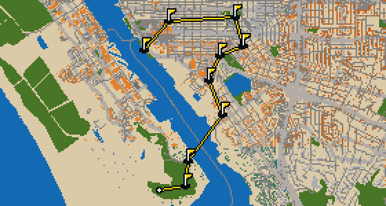
The Vallejo Naval and Historical Museum is the end of this quick nine-hole round. The map is the real city and the ball rolls across its actual streets, banking off building facades. Local attractions provide the structure for each hole. Skip knows these sidewalks well, including the 3.7 mi walk and the two portals used to bridge the gaps.

9 HOLES - PAR 28

Salinas

9 stops

Salinas is the setting for this round, with the ball rolling across the actual city streets. The holes are built from real attractions, including the National Steinbeck Center. Skip knows these sidewalks well and has a few feathers in the wind. This quick round of 9 holes has a par of 28 and covers a total walk of 3.7 mi.

18 HOLES - PAR 55

Ontario

18 stops

This is Ontario. The map is the real city and the round is played on its real streets, where attractions like the Benton Museum of Art are what the holes are built from. Skip is a local guide who knows the place, including which ledges offer the best view of the action. A full round of 18 holes covers 7.1 mi with a par of 55. It is a steady walk through the city that lets the course unfold naturally.

FAQ

Is it free to play?

Yes. Every course runs in the browser with no account and no install.

Do I need to be in the city?

No. The full round plays from anywhere. Walking the real route is a nice way to see the city, but it is not required.

Are the maps real?

Yes. The geometry comes from OpenStreetMap data, rendered chunky on purpose. Streets, water and parks sit where they really are.