
TRUJILLO - 9 HOLES - FREE

TRUJILLO
CITY MAP MINIGOLF

Trujillo - 9 stops - par 27

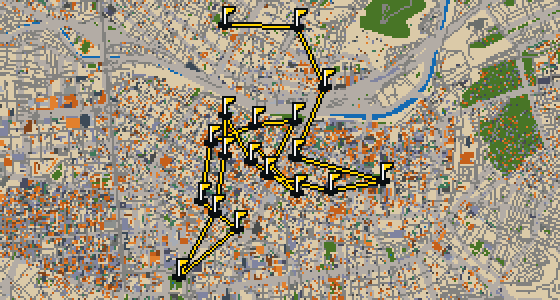
This is a quick nine-hole round through Trujillo. The map follows the real city, with the ball rolling across actual streets and banking off building facades. Real attractions like the Palacio Iturregui are the holes, and two portals help bridge the distance. Skip knows these corners well and will be the local guide for the 4.9 km walk.

Trouble loading? Open the game in its own tab.

HOW IT WORKS

01

Pick a city

The course is drawn on the real street grid, so the map you play is the map you walk.

02

Putt to the pin

Drag to aim, release to swing. Buildings bounce and water costs you a stroke.

03

Sightsee between strokes

Every hole ends at an attraction. Sink the putt, read the story, walk to the next tee.

THE TRUJILLO ROUND - STOP BY STOP

HOLE 1 - PAR 3

Estadio Mansiche

Let me show you Estadio Mansiche. This stadium is the largest in the city of Trujillo and has a capacity of a little over 25,000. It was started in 1946 and is the home for football clubs Carlos A. Mannucci and Universidad César Vallejo. If you look past the pitch, you can pick out a running track used for track and field sports. The stadium is part of the Mansiche Sports Complex, which also includes a swimming pool and the Coliseo Gran Chimu. It is a place where the city gathers for competition and celebration. I have seen plenty of crumbs dropped by excited fans in these stands over the years, which makes for a very productive afternoon for a bird like me.


Wikidata · Wikipedia

HOLE 2 - PAR 3

Museo de Juguete

HOLE 3 - PAR 3

Casa Urquiaga

HOLE 4 - PAR 3

Museo Arqueologico

HOLE 5 - PAR 3

Casa del Mayorazgo de Falcalá

HOLE 6 - PAR 3

Palacio Iturregui

Let me show you Palacio Iturregui, a palace built in the Neoclassical architecture style. When you look at the facade, you can pick out the symmetry and balance typical of this design, which gives the building its distinct and orderly appearance. Beyond its visual appeal, the site is recognized as a cultural property and is part of the cultural heritage of Peru. It is a place where the city's history is physically preserved for everyone to see, providing a tangible link to the past through its walls and layout. I've noticed that the clean lines of the building make it a great landmark for getting your bearings in the neighborhood, especially when you are navigating the streets nearby. It is one of those spots that really helps you feel the weight of the local history as you walk past.

Wikidata

HOLE 7 - PAR 3

Portada de la Sierra

HOLE 8 - PAR 3

Catedralicio

HOLE 9 - PAR 3

Iglesia El Carmen

STOP 10

Iglesia San Agustín

OTHER COURSES

9 HOLES - PAR 27

Arequipa

9 stops

This is Arequipa. The map is the real city and the round is played on its real streets, where attractions like the Monasterio de Santa Catalina are the holes. Skip is a local guide who knows the place. This quick round of 9 holes is a 5.3 km walk with a par of 27, using 10 portals to move between districts.

18 HOLES - PAR 53

Lima

18 stops

The ball finds the cup at the Catedral de Lima to finish a full round of 18 holes. This course uses the real streets of Lima as the map, with the city's actual attractions forming the obstacles and holes. A local guide like Skip knows these corners well, including where to find the best crumbs. The walk covers 11 km and uses 10 portals to move between districts, with a total par of 53.

9 HOLES - PAR 25

Cusco

9 stops

Cusco is the setting for this round, played on the actual streets of the city. The map follows the real layout, where attractions like Sacsayhuamán become the holes. A quick 9-hole round with a par of 25 covers a walk of 4.5 km. Skip knows every cobblestone and crumb of bread in this place and acts as the local guide.

FAQ

Is it free to play?

Yes. Every course runs in the browser with no account and no install.

Do I need to be in the city?

No. The full round plays from anywhere. Walking the real route is a nice way to see the city, but it is not required.

Are the maps real?

Yes. The geometry comes from OpenStreetMap data, rendered chunky on purpose. Streets, water and parks sit where they really are.