
PADUA - 18 HOLES - FREE

PADUA
CITY MAP MINIGOLF

Padua - 18 stops - par 53

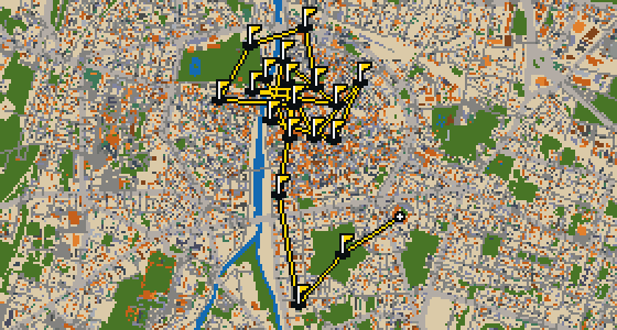
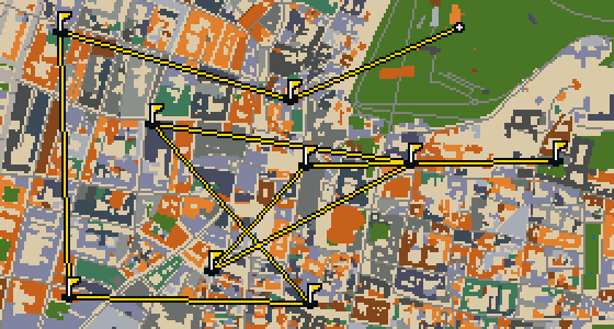
This is a full round through Padova, covering 10.3 km of the real city. The ball rolls across actual streets, banking off building facades toward holes built from real attractions like the Orto Botanico 1545. Skip is a local guide who knows these pavements well and can find a stray seed in any alley. The course consists of 18 holes with a par of 53, using 24 portals to leap between the more distant districts of the map.

Trouble loading? Open the game in its own tab.

HOW IT WORKS

01

Pick a city

The course is drawn on the real street grid, so the map you play is the map you walk.

02

Putt to the pin

Drag to aim, release to swing. Buildings bounce and water costs you a stroke.

03

Sightsee between strokes

Every hole ends at an attraction. Sink the putt, read the story, walk to the next tee.

THE PADUA ROUND - STOP BY STOP

HOLE 1 - PAR 2

Orto Botanico 1545

I can show you the Orto Botanico 1545, a botanical garden located in Padua, in the northeastern part of Italy. It encompasses roughly 22,000 square meters of greenery. The Venetian Republic founded the garden in June 1545, and it is now owned by the Italian government. Today, the University of Padua operates the site. It is a place where nature and academia meet, and it is recognized as a World Heritage Site. I always find the air here a bit fresher than the city streets.


Wikidata · Wikipedia

HOLE 2 - PAR 3

Basilica di sant'Antonio Di Padova

The Basilica di sant'Antonio Di Padova is an international shrine and a Catholic church located in Padua, Veneto, Northern Italy. This minor basilica is also a convent and is recognized as part of a UNESCO World Heritage Site. Visitors can observe a blend of architectural influences, as the building incorporates both the Romanesque art style and the Renaissance style. The inception of the site was in 1238. It stands as a significant place of worship and history within the region of Veneto, maintaining its dual role as a convent and a minor basilica.

Wikidata · Wikipedia

HOLE 3 - PAR 3

Tomba di Antenore

Located in Piazza Antenore in the Veneto region of Italy, this 13th-century monument is a grave and aedicula. It was created to honor an unearthed ancient sarcophagus. This site is tied to the city's origins, as the sarcophagus is claimed to be that of Antenor. He was a Trojan warrior and counselor who is known as the legendary founder of Padua. You can also find this landmark referred to as the Sepulchre of Antenore. I've noticed the square stays quite peaceful, making it a nice spot to stop and look at the stonework.

Wikidata · Wikipedia

HOLE 4 - PAR 3

Duomo di Padova

Located on the east end of Piazza Duomo, Duomo di Padova is a cathedral and a minor basilica. It is a Catholic church that incorporates both Renaissance and baroque architecture styles. Also known as the Basilica Cathedral of Saint Mary of the Assumption, the inception of this building was in 1754. You can find the site situated adjacent to the bishop's palace in Padua, Veneto, Italy. It is a place of worship where the architecture tells a story of different eras coming together in one space.

Wikidata · Wikipedia

HOLE 5 - PAR 3

Museo di Astronomia

Look up at La Specola, a 14th-century tower that defines the skyline here. In 1767, this structure was converted into an astronomical observatory in Padua, within the Veneto region of Italy. Today, the site functions as the Museo di Astronomia, an astronomical museum where you can explore the history of the stars. It is a public entity that welcomes 590 annual visitors. I've noticed the tower provides a great vantage point for anyone watching the city from above, though it is much more famous for what happens at the top than for the view of the streets.

Wikidata · Wikipedia

HOLE 6 - PAR 4

Porta San Giovanni

You will first notice the classical proportions of Porta San Giovanni, a city gate that stands as a testament to Renaissance design. Giovanni Maria Falconetto is the architect of this structure, which helped define the boundaries of the city in a style that still draws the eye today. Beyond its visual appeal, the gate is officially recognized as an Italian national heritage. It is a great spot to pause and appreciate the scale of the old fortifications before moving on to the next street.

Wikidata

HOLE 7 - PAR 3

Porta Savonarola

Look closely at the stone work of Porta Savonarola. This city gate was designed by the architect Giovanni Maria Falconetto and remains a prominent feature of the local architecture. It is recognized as an Italian national heritage, marking a point where the city's old defenses meet the modern streets. I've always found the scale of these old gates impressive when you're walking right up to them, as they make the current traffic feel quite small by comparison. It is a great spot to stop and appreciate the transition from the center to the outskirts.

Wikidata

HOLE 8 - PAR 3

Porta di Ponte Molino

Let me show you Porta di Ponte Molino, a city gate that stands 26 meters tall. While it once served as a functional entrance to the city, it is now regarded as an Italian national heritage. You can pick out the scale of the masonry as you pass by, which gives you a sense of the city's old boundaries. I've found that the height makes it a great landmark for keeping your bearings in this part of town, especially when the streets start to feel a bit repetitive. It is a sturdy reminder of the city's past.

Wikidata

HOLE 9 - PAR 3

Chiesa degli Eremitani

The Chiesa degli Eremitani is a church building whose inception was in 1276. This 13th-century Gothic-style church is an Italian national heritage and is also built in the Romanesque architecture style. It is part of the UNESCO World Heritage Site of Padua's 14th-century fresco cycles. To the left of the entrance, you can find the former Augustinian monastery which now houses the Musei Civici agli Eremitani. The building is located adjacent to the Cappella Scrovegni, making this a significant area for those visiting the region of the Veneto in Italy.

Wikidata · Wikipedia

HOLE 10 - PAR 3

Palazzo della Ragione

The Palazzo della Ragione is a medieval market hall, town hall and palace of justice building in Padua. Located in the Veneto region of Italy, the building is Italian national heritage. You can pick out how the structure splits the city's layout, as the palace separates Piazza delle Erbe from Piazza dei Frutti. The ground floor hosts the historical covered market of the city, while the upper floor was dedicated to the town and justice administration. I've noticed the ground floor is always a great spot to see the city's daily rhythm.

Wikidata · Wikipedia

HOLE 11 - PAR 3

Cappella degli Scrovegni

The Cappella degli Scrovegni reaches a height of 18.5 meters. This chapel is an example of Gothic architecture and its inception was 1305. It is recognized as Italian national heritage and is part of a UNESCO World Heritage Site. Today, it is a religious museum that welcomes 9,387 visitors every year. You can see how the structure fits into the local streetscape while appreciating the specific architectural style of the period. It remains one of the most significant sites in the city for those interested in religious art and history.

Wikidata · Wikipedia

HOLE 13 - PAR 2

Chiesa di San Gaetano

Vincenzo Scamozzi is the architect of the Chiesa di San Gaetano, and he specifically designed the facade of the building. This church building is a notable example of the Renaissance architecture style. Located in the central district of Padua, the site is recognized as an Italian national heritage. Visitors can observe the specific influence of Scamozzi on the exterior of the structure, which reflects the formal standards of the period. It remains a significant landmark for those exploring the central part of the city.

Wikidata · Wikipedia

HOLE 14 - PAR 3

Porta Altinate

Look closely at the stonework of Porta Altinate. This structure is a city gate and is recognized as Italian national heritage. It stands as a point of entry into the city, marking a boundary that remains a part of the local identity. I often see people pausing here to admire the architecture before heading further into the center. It is a great spot to get your bearings before you continue your walk through Padova, and it provides a sense of scale for the old fortifications that once surrounded the area.

Wikidata

HOLE 15 - PAR 3

Santa Sofia

Bishop Sinibaldo received a grant for this church in 1123. Santa Sofia is a church building and the oldest Roman Catholic church structure in the city of Padua, region of Veneto, Italy. It was originally built in the 10th century on the site of a presumed Mithraeum, and the structure you see now was started in 1127. This site is an Italian national heritage site and is built in the Romanesque architecture style. The stone and brick facade was constructed from 1106 to 1127, reflecting the early architectural traditions of the region.

Wikidata · Wikipedia

HOLE 16 - PAR 4

Porta Ognissanti

Let me show you Porta Ognissanti, which is a city gate. This structure is an Italian national heritage, making it a significant stop for anyone exploring the local history of Padova. It is the kind of spot where you can slow down and appreciate the old stone and the way the city once managed its entries. I've noticed that the architecture here has a certain weight to it that feels very grounded, which is likely why it remains such a sturdy part of the city's edge today.

Wikidata

HOLE 17 - PAR 3

Chiesa di San Francesco

The Gothic architecture of Chiesa di San Francesco defines this church building on the Via San Francesco in Padua, Italy. Dedicated to saint Francis of Assisi, it is an Italian national heritage site. Its inception was in 1414, and it has been known for centuries as San Francesco Grande. Beyond the church itself, the site once hosted the convent of the Friars Minor and the Hospital of Saint Francis, Major. These institutions operated as part of the religious community on this site until 1798, marking a long period of service to the city of Padua.

Wikidata · Wikipedia

HOLE 18 - PAR 2

Isola Memmia

You first notice the water and the greenery of Isola Memmia, a green island at the center of Prato della Valle. This island is surrounded by a small canal, which is bordered by two rings of statues. The surrounding Prato della Valle is an elliptical square in Padua, Italy, measuring 90,000 square meters. It is the second largest square in Italy and one of the largest squares in Europe. I find the layout of the canal quite relaxing to walk around.

Wikidata · Wikipedia

STOP 19

Abbazia di Santa Giustina

The Early Christian architecture style defines the presence of the Abbazia di Santa Giustina. This minor basilica and Benedictine abbey is an Italian national heritage. While the basilica church was initially built in the 6th century, its present form derives from a 17th-century reconstruction. The inception of the current structure was in 1530 and it was designed by the architect Sebastiano da Lugano. It remains a significant church building in Padova, where you can see the influence of these different eras of construction in one place.

Wikidata · Wikipedia

OTHER COURSES

9 HOLES - PAR 26

Reggio Emilia

9 stops

Reggio nell'Emilia is the setting for this round, where the map is the actual city and the ball rolls along its real streets. The holes are built from local attractions, including the Cattedrale di Santa Maria Assunta. Skip knows these blocks well. This quick 9-hole round covers a 5 km walk with a total par of 26.

9 HOLES - PAR 26

Modena

9 stops

From a rooftop perch, Modena looks like a clean slate for a quick nine-hole round. The map is the real city and the ball rolls across its actual streets, using attractions like the Duomo di Modena as the holes. Two portals help skip the long stretches of a 4.8 km walk. Skip knows these alleys well and will be the local guide.

18 HOLES - PAR 55

Parma

18 stops

This is Parma, where the map is the real city and the round is played on its actual streets. The holes are built from real attractions, ending the walk at the Torrione Visconteo. Skip is a local guide who knows the place and where the best crumbs are hidden. A full round of 18 holes takes a 10.5 km walk with a par of 55, using four portals to bridge the gaps.

9 HOLES - PAR 26

Brescia

9 stops

Brescia is the setting for this round, with the ball rolling across the real streets of the city. The holes are built from actual attractions, including the Castello di Brescia. This quick 9-hole round covers 4.9 km and uses 16 portals to move between districts. Skip knows these pavements well and is the local guide.

9 HOLES - PAR 27

Reggio Calabria

9 stops

Reggio di Calabria is the setting for this round, where the map follows the real city and the ball rolls across its actual streets. Real attractions like the Castello Aragonese provide the architecture for the holes. This is a quick nine-hole round covering a 5.6 km walk. I know these sidewalks well and will act as the local guide.

FAQ

Is it free to play?

Yes. Every course runs in the browser with no account and no install.

Do I need to be in the city?

No. The full round plays from anywhere. Walking the real route is a nice way to see the city, but it is not required.

Are the maps real?

Yes. The geometry comes from OpenStreetMap data, rendered chunky on purpose. Streets, water and parks sit where they really are.