
El Prado
Let me show you El Prado. This place is a promenade located in the heart of the city. It is a spot where you can walk and take in the surroundings of La Paz. I find it a pleasant place to spend some time while moving through the center.
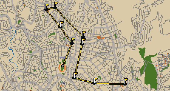
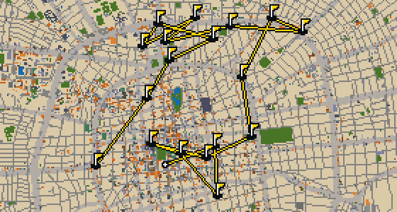
La Paz - 9 stops - par 29
This quick nine-hole round takes place on the actual streets of La Paz. The ball rolls through the city, banking off real facades to reach landmarks like Plaza Murillo. Skip knows every alley and altitude change here. The 6.3 km walk is spread across the map, using 16 portals to bridge the gaps between the attractions.
The course is drawn on the real street grid, so the map you play is the map you walk.
Drag to aim, release to swing. Buildings bounce and water costs you a stroke.
Every hole ends at an attraction. Sink the putt, read the story, walk to the next tee.
Let me show you El Prado. This place is a promenade located in the heart of the city. It is a spot where you can walk and take in the surroundings of La Paz. I find it a pleasant place to spend some time while moving through the center.
You will first notice the cluster of imposing buildings surrounding Plaza Murillo. This square is the central plaza of La Paz and sits within the Casco Viejo, the city's old town. It is a hub of power where the Plurinational Legislative Assembly of Bolivia and the Palacio Quemado stand as prominent landmarks. The Cathedral of La Paz and the Casa Grande del Pueblo also overlook the space. If you are navigating the area, you can find Socabaya Street to the west and Ayacucho Street to the east. Comercio Street borders the square to the south. I've found that the mix of architecture here makes it a great spot to just sit and watch the city move.
The Basílica de San Francisco is a minor basilica located in the center of La Paz, Bolivia. Situated in Plaza San Francisco, this church building is a Catholic church under the advocation of Francis of Assisi. You can pick out the baroque architecture style used in its design, which characterizes the exterior and the structure of the building. The inception of the Basílica de San Francisco was in 1743. It remains a significant site within the city center for those interested in the religious and architectural history of the region. By visiting the plaza, you can see how the basilica fits into the urban layout of the city center while focusing on the specific baroque details that define its appearance.
You might mistake this for a simple municipal office or a private residence, but it is actually the Casa de la Cultura Franz Tamayo. This site is a museum that holds a place of high honor in the city. Beyond its role as a gallery for the arts, the building is officially recognized as a national monument of Bolivia. When you visit, take a moment to appreciate how the structure fits into the surrounding neighborhood. I've noticed that the architecture here has a way of making you slow your pace as you walk by. Whether you are interested in the arts or the official history of the country, this museum is a key stop for anyone wanting to understand the local spirit.
Located within the city, Basílica María Auxiliadora is a church building. It is a site of significance as a national monument of Bolivia. This designation reflects its importance to the country and its role as a preserved piece of architectural history. Visitors to the area can observe the presence of the building and its place within the urban environment. In addition to its status as a national monument, the site is officially recognized as a cultural property. It remains a point of interest for those visiting the city who wish to see the local landmarks that have been protected for their historical and cultural value. This church building stands as a direct example of the city's religious architecture and its commitment to preserving its national heritage for future generations to see.
Let me show you Parque Urbano Central. This place is a park that provides a breath of fresh air for everyone visiting or living in La Paz. While the city is known for its steep climbs and busy streets, this spot offers a different pace. You can pick out the greenery that makes it a standout feature of the local area. I've found that it's a great place to simply sit and watch the world go by without any rush. Whether you are here for a quick stop or a longer stroll, it's a useful landmark for anyone navigating the city center.
In the Sopocachi area of La Paz, you will find Plaza Abaroa. This public square is located among Belisario Salinas, Pedro Salazar, Sánchez Lima, and 20 de Octubre streets. It is a place of local importance named in honor of Eduardo Abaroa. Abaroa is remembered as a Bolivian hero who fought in the War of the Pacific. I often see people gathering here to enjoy the open space in the middle of the city. Whether you are passing through on your way to another landmark or taking a break from the bustle of the surrounding streets, it is a central spot to observe the daily rhythm of the neighborhood. It is a useful place to pause and get your bearings before heading further into the city of La Paz, Bolivia.
Sucre is the setting for this round, where the map follows the actual city layout and the ball rolls across real streets. The holes are built from local attractions, starting at Estadio Olímpico Patria. I know these sidewalks well and will guide the way through a quick 9-hole round covering 5.3 km. A few crumbs might fall along the path, but the focus stays on the course.
This is a full round of 18 holes through Santa Cruz de la Sierra. The map follows the real city and the ball rolls across its actual streets, using landmarks like the Monumento Cristo Redentor to form the holes. Six portals help the ball skip across a total walk of 10.3 km. Skip knows every corner of this place, including exactly which ledges hold the best crumbs. This local guide sees the city from a bird's eye view and knows the streets by heart.
Yes. Every course runs in the browser with no account and no install.
No. The full round plays from anywhere. Walking the real route is a nice way to see the city, but it is not required.
Yes. The geometry comes from OpenStreetMap data, rendered chunky on purpose. Streets, water and parks sit where they really are.