
VIÑA DEL MAR - 18 HOLES - FREE

VIÑA DEL MAR
CITY MAP MINIGOLF

Viña del Mar - 18 stops - par 57

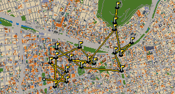
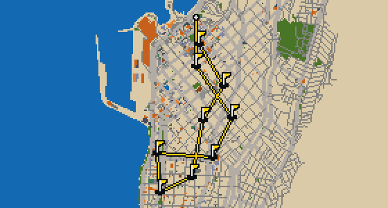
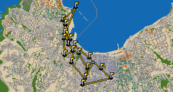
Viña del Mar is the setting for this round, played on the actual streets and mapped to the real city. The holes are built from local attractions, ending with a final cup at Plaza Eleuterio Ramírez. Skip knows every sidewalk and crumb-filled corner here and will act as the local guide. This full round of 18 holes covers 12.8 km with a par of 57, using 10 portals to move the ball between distant districts.

Trouble loading? Open the game in its own tab.

HOW IT WORKS

01

Pick a city

The course is drawn on the real street grid, so the map you play is the map you walk.

02

Putt to the pin

Drag to aim, release to swing. Buildings bounce and water costs you a stroke.

03

Sightsee between strokes

Every hole ends at an attraction. Sink the putt, read the story, walk to the next tee.

THE VIÑA DEL MAR ROUND - STOP BY STOP

HOLE 1 - PAR 3

Catedral de Valparaíso

The Gothic Revival style defines the architecture of the Catedral de Valparaíso. This cathedral is located in the El Almendral neighborhood, situated specifically on the east side of the Plaza de la Victoria. It is a Historical Monument of Chile and serves as the cathedral of the Roman Catholic Diocese of Valparaíso. Visitors to the area can see how the church anchors the plaza and the surrounding neighborhood, marking it as a significant site of both religious and historical importance in Chile.


Wikidata · Wikipedia

HOLE 2 - PAR 4

Museo Organológico

As you navigate the streets of Viña del Mar, you will find the Museo Organológico. This site is a private museum that focuses on art. It provides a dedicated space for visitors to experience art collections within the city. I've noticed the area around here has a great energy for walking, making it a pleasant spot to stop and look around. Whether you are a lifelong art enthusiast or just passing through on a stroll, this private art museum is a distinct landmark to visit while you are exploring the neighborhood.

Wikidata

HOLE 3 - PAR 3

Parque Cultural de Valparaíso

Parque Cultural de Valparaíso is a building complex that functions as a cultural center. If you are visiting the area, you can find a private museum and an archaeological museum located here. The site is officially designated as a Historical Monument of Chile. I have found that the layout makes it a great spot for a walk between exhibits. It is a place where the city's creative spirit is on full display across the various galleries and open spaces. Whether you are looking for history or contemporary works, there is plenty to see within this expansive cultural hub.

Wikidata

HOLE 4 - PAR 3

Reloj Turri

Let me show you Reloj Turri, a building situated in the center of Viña del Mar. This landmark is designed in the Neoclassical architecture style, which gives it a distinct look compared to the modern surroundings. Work on the structure started in 1924, and it has since become a fixed point for the city's layout. I usually see plenty of people gathering around the base to check the time, though I personally prefer the view from the high ledges where the wind is strongest.

Wikidata

HOLE 5 - PAR 3

Arco Británico

You will first notice the imposing structure of the British Arch, a triumphal arch located on Brazil Avenue in Valparaíso. This monument was designed by the Chilean architect Alfredo Azancot. It was donated to the town in 1910 by the British community living there to mark the centenary of the Independence of Chile. After the design and donation, the arch was unveiled in 1911. I've seen plenty of things land on the streets of Valparaíso, but this is certainly the most permanent gift the British left behind.

Wikidata · Wikipedia

HOLE 8 - PAR 3

Teatro Mauri

Let me show you Teatro Mauri. This site is a theatre building used for hosting various stage productions and events. It is a place where the community gathers to enjoy the arts. I have seen many people enter these doors for a show.

Wikidata

HOLE 9 - PAR 3

Museo a Cielo Abierto de Valparaíso

Let me show you the Museo a Cielo Abierto de Valparaíso. This site is a museum. I've noticed it is a great spot to see how the city integrates its displays.

Wikidata

HOLE 10 - PAR 3

Plaza Aníbal Pinto

You will likely notice the Fuente de Neptuno first when you arrive at Plaza Aníbal Pinto. This square is a Typical Zone heritage site built on reclaimed land. While it is now named after President Aníbal Pinto, the space was formerly called Plaza del Orden. The Fuente de Neptuno fountain was erected in 1892. It is a great spot to pause and look around the city. I have seen a few crumbs dropped near the fountain that make it a favorite stop for my friends, though you should keep your eyes on the architecture.

Wikidata · Wikipedia

HOLE 12 - PAR 3

Ascensor Artillería

Let me show you the Ascensor Artillería, a funicular and a monument. This railway links the plan of the city with the Artillería hill. It is a Historical Monument of Chile and one of 16 funicular railways located in Valparaíso. While it is privately owned, you should know that it closed in May 2021. I have seen plenty of these cars climb the steep slopes over the years, though this particular one is currently still. It remains a significant piece of the local infrastructure for anyone visiting the area.

Wikidata · Wikipedia

HOLE 13 - PAR 3

Monumento a los Héroes de Iquique

Norbert Maillart is the architect of the Monumento a los Héroes de Iquique. This site is a monument and a tomb of the unknown soldier. Visitors to Viña del Mar can find this landmark as a point of reflection. It remains a significant location because it is a monument and a tomb of the unknown soldier, both of which are attributed to the design work of Norbert Maillart.

Wikidata

HOLE 14 - PAR 3

Museo Marítimo Nacional

Let me show you the Museo Marítimo Nacional. This maritime museum was founded in 1915, making it a long-standing fixture of the local waterfront. Since its early days, the site has gained significant recognition and is now a Historical Monument of Chile. Visitors can explore the collections of this public museum to learn about the history of the sea and the ships that sailed these coasts. I've noticed that the air here always smells of salt and old wood, which makes the whole experience feel more authentic as you walk through the exhibits.

Wikidata

HOLE 15 - PAR 4

Faro Recinto Portuario Primera Zona Naval

Let me show you the Faro Recinto Portuario Primera Zona Naval. This lighthouse reaches a height of 16 meters and helps keep ships safe as they navigate the coast. Work to build the structure started in 1921. I often see the light flashing against the evening sky while I am out on my rounds, and it is a steady landmark for anyone looking toward the harbor. It is a functional piece of the city's maritime history that remains a vital part of the local naval zone today.

Wikidata

HOLE 16 - PAR 3

Plaza Echaurren

Let me show you Plaza Echaurren. This spot is a square located within the city. It is a place where you can pause during your walk to see the local surroundings. I have noticed that the open space makes it a handy spot for getting your bearings before moving on to the next destination.

Wikidata

HOLE 18 - PAR 3

San Luis de Gonzaga

San Luis de Gonzaga is a church building. It is a place of worship characterized by the Romanesque Revival architecture style. This style is evident in the design and construction of the building, making it a distinct landmark for those visiting the area. Visitors can observe the specific architectural elements that define the Romanesque Revival influence throughout the exterior and interior of the site.

Wikidata

STOP 19

Plaza Eleuterio Ramírez

Let me show you Plaza Eleuterio Ramírez. This location is a square that sits within the city. It is a place where you can stop and orient yourself while exploring the surrounding streets. I have found that the open layout makes it a great spot for people-watching while you take a break from your walk.

Wikidata

OTHER COURSES

18 HOLES - PAR 57

Santiago

18 stops

This is Santiago. The map is the real city and the round is played on its real streets, starting at the Palacio de La Moneda. Real attractions are what the holes are built from, and Skip is a local guide who knows the place. This full round of 18 holes is a 11.5 km walk with a par of 57, using 30 portals to bridge the gaps.

9 HOLES - PAR 26

Antofagasta

9 stops

Antofagasta is the map for this round, with the ball rolling across its actual streets. The holes are built from real attractions, ending at the Catedral de Antofagasta. Skip knows every corner of the city and acts as the local guide. This quick 9-hole round covers 4.9 km with a total par of 26.

18 HOLES - PAR 57

Valparaíso

18 stops

This is Valparaíso. The map is the real city and the round is played on its real streets, where the ball banks off facades and rolls toward landmarks like the Catedral de Valparaíso. These real attractions are what the holes are built from. Skip is a local guide who knows the place, even the best spots to find a stray crumb. This full round of 18 holes covers 12.8 km with a par of 57, using 10 portals to bridge the gaps between the hills.

FAQ

Is it free to play?

Yes. Every course runs in the browser with no account and no install.

Do I need to be in the city?

No. The full round plays from anywhere. Walking the real route is a nice way to see the city, but it is not required.

Are the maps real?

Yes. The geometry comes from OpenStreetMap data, rendered chunky on purpose. Streets, water and parks sit where they really are.